
Tides and winds influence the height of the sea level. On the island of Heligoland, GFZ uses a superconducting gravimeter to observe these short-term sea level changes in the North Sea as well as the uplift and subsidence of the Earth's crust as a result of the redistribution of large water masses.
Text: Dr.-Ing. Christian Voigt, GFZ
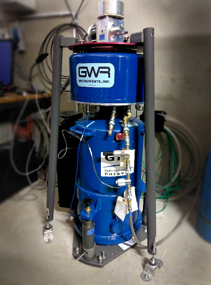
Foto: Christian Voigt, GFZ
On the island of Heligoland, scientists at the Biological Institute study the ecology of coastal and shelf sea systems. However, the North Sea island in the middle of the German Bight is not only ideally suited for marine biological analyses, but also for the (geodetic) observation of sea level changes. Since 2020, the station has also been used by GFZ as a site for a superconducting gravimeter (Voigt 2020). At this location, the mass variations in the North Sea and their influence on the solid Earth's crust are particularly pronounced and can thus be observed very well. The gravimeter responds to the water mass variations in two ways: On the one hand, an increase in water in the German Bight, e.g. due to high water or storm surge, leads to an increase in gravity in the gravimeter according to Newton's law of gravitation. This direct attraction of the water masses has a strongly dominant local character and is reduced for our purposes from the observations of the gravimeter using local tide gauge data. On the other hand, an increase of water in the German Bight leads to an elastic subsidence of the earth's crust on which the gravimeter stands. This so-called ocean loading effect leads to a further increase in gravity, since the gravimeter is now closer to the center of mass of the Earth. These very large-scale loading effects, with several 100 km pronounced, are of particular interest to us because they provide an interface between the geodetic observation techniques of superconducting gravimetry, satellite gravimetry (GRACE-FO), and GNSS (Global Navigation Satellite Systems).
Magnitude of observations
Ocean tides are the periodic water mass variations with distinct diurnal and semidiurnal periods. On the island of Heligoland, the difference between mean high tide and low tide is a approx. 2 meters. This leads to vertical deformations of the earth's crust of about 20 mm in total (uplift-subsidence) and to gravity variations of 40 nm/s². The ocean tides are always superimposed by non-tidal variations, especially caused by strong winds or storms. The largest measured storm surge signals since the beginning of the gravimeter time series on the island of Heligoland occurred due to the passage of the storm low NADIA on 30 Jan 2022 at wind force 9 from the west. At a water level of 2.0 m above mean high tide on the island of Heligoland, the gravity observations increased by almost 90 nm/s². From observations of the GNSS stations on Heligoland, subsidence of the earth's crust by up to 35 mm can be derived. In Potsdam these signals still amount to about 15 nm/s² and 5 mm, respectively, and are thus visible in all precise geodetic observations.
Transition from point to areal observation
A fundamental challenge for the validation and combination of satellite data with terrestrial observations is always their different sensitivity. While GRACE-FO provides gravity variations globally with a resolution of about 300 km x 300 km on a monthly basis, superconducting gravimeters observe gravity variations every second and in full resolution - but only in the measurement point and its surroundings. Various approaches now exist to close the observational gap between the different observational techniques. For example, on Mt. Zugspitze, a summit location was chosen to capture the entire mountain catchment from a "bird's eye view" (Voigt 2023). On the island of Heligoland, it is exploited that the largest unknown signal are the large-scale ocean loading effects due to water mass variations in the German Bight. Typically, these signals are reduced using models as part of the standard processing of GRACE-FO. However, these models are not perfect, but have a significant contribution to the uncertainty budget of GRACE-FO. Our measurements on the island of Heligoland show us the discrepancies between these models and the real observed signal as well as the improvements by a much higher resolution circulation model from the Federal Maritime and Hydrographic Agency of Germany. Furthermore, the findings on Heligoland can be used for an improved reduction of gravimetric and GNSS observations on continental stations.
Further information
- Information about the superconducting gravimeter on the GFZ webseite
- Voigt, C. (2020): Ebbe und Flut auf den Kontinenten. - Physik in unserer Zeit, 51, 6, 305-305.
https://doi.org/10.1002/piuz.202070609 - Voigt, C. (2023) Forschung in luftiger Höhe: Der Wasserhaushalt in den Alpen. Beilage der Geographischen Rundschau 3-2023 in Kooperation mit dem Deutschen GeoForschungsZentrum GFZ