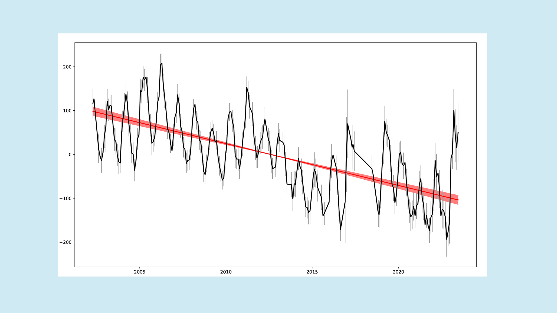
Looking at the maps of terrestrial water storage (TWS) across the continents, you can discover many interesting details, especially if you analyse the temporal variations in an area. But when these time series are used to conclude the long-term change in water storage, scientists should ask themselves: How precisely do we know this? Is a trend of 0.1mm per year already statistically significant, or is that just measurement noise? The answer to these questions is more complex and is still the subject of ongoing scientific debate. In this article, we will take a closer look at what influences (or could influence) the uncertainties of TWS observations and how these have been realised in practice.
Dr. Eva Boergens, GFZ
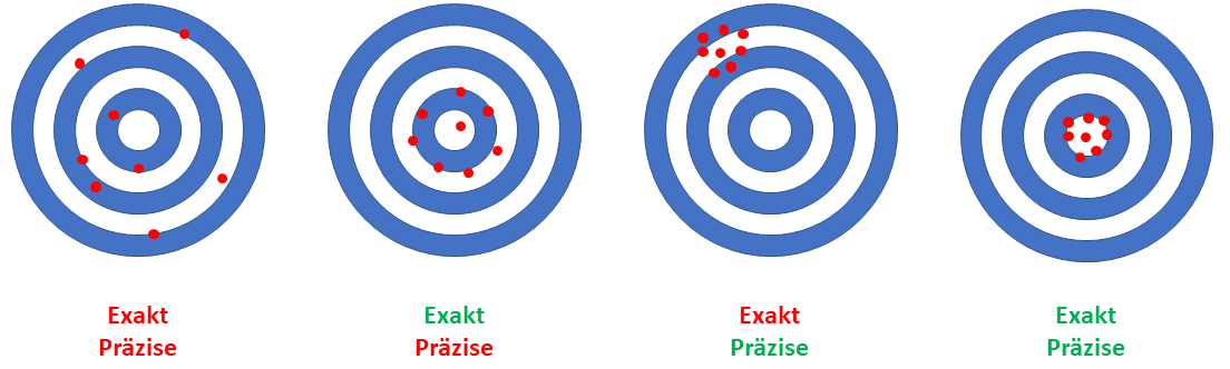
All measuring devices have certain measurement uncertainties, including the instruments on the GRACE satellites. We use the term "measurement uncertainty" in this article as it is more appropriate than the common term "measurement error". In the statistical sense, measurement error is a measure of accuracy, whereas measurement uncertainty describes precision. The accuracy of the instruments is a systematic effect that we try to prevent or reduce through instrument calibration.
On board the two GRACE satellites are various measuring instruments needed to calculate monthly Earth gravity fields. In addition to the central interferometer (or two interferometers on GRACE-FO), which measures the changes in the distance between the satellite pair, these include GNSS receivers, star cameras and accelerometers. All these instruments have different uncertainty characteristics, some of which are insufficiently known despite instrument calibration. To make matters worse, some uncertainties are also variable over time! Thus, the measurement uncertainties continue into the derived monthly gravity fields. The complete tracking of all measurement uncertainties through the processing chain has yet to take place; instead, the uncertainties are estimated using empirical models.
Background models are also required in the processing of the monthly solutions. These are necessary to model geophysical processes with frequencies shorter than one month and, therefore, cannot be modelled correctly by monthly solutions. These background models include tidal models and non-tidal ocean and atmospheric models. Since these models are also fed with meteorological data, they, too, contain uncertainties. In addition to the background models, models are used in the processing of monthly gravity fields into gridded TWS data products to reduce the effect of glacial isostatic adjustment (GIA) as well as the co- and post-seismic deformations after the three megathrust earthquakes (Sumatra-Andaman 2004, Chile 2010, and Japan-Tohoku 2011). Large earthquakes lead to rapid and massive mass displacements that can be observed with the GRACE satellites. To avoid distorting the hydrological signals in TWS around the earthquakes, these gravitational earthquake signals must be reduced. The uncertainties of all these models are currently not explicitly considered in the uncertainty estimation, although they most likely also introduce systematic errors.
At present, the uncertainties of the spherical-harmonic coefficients are determined empirically during the estimation of the monthly gravity fields. Thanks to ever-improving statistical models in data processing, these empirical uncertainties reflect reality well.
Another source of uncertainty in the TWS data is the estimation and correction of the leakage effect. This effect describes that mass changes on the Earth's surface can only be localised "blurred" in TWS. One reason is that the two satellites observe the Earth's gravity field from a distance of 500 kilometres, which already results in a blurring. In addition, the monthly gravity fields must be filtered to eliminate high-frequency errors. For example, some of the mass variation of the Amazon basin can be seen in grid points in neighbouring areas. There are now many methods to relocalise this mass signal, but with the risk of systematic error.
The large number of different sources of uncertainty on the final TWS data product makes a purely analytical derivation of uncertainty measures for TWS extremely difficult. Nevertheless, users of TWS data need realistic estimates of these uncertainties and their spatial and temporal correlations to apply the data. One possibility is to propagate the empirical uncertainty estimates of the monthly fields to the TWS grids using variance propagation. That results in a realistic TWS covariance matrix per month, which is, however, approx. 34 GB in size.
On the one hand, handling such a covariance matrix is often beyond the capabilities of the data users. On the other hand, it is also difficult for the data producers to provide it. For this reason, the GFZ scientists have developed a model that calculates time-dependent spatial covariances for TWS from empirical estimates.
In practice, the uncertainties of different months are compared by looking at the noise over the oceans. Compared to the glaciated regions and the continents, the open oceans have significantly less signal variation, especially when a trend and a seasonal signal are reduced. Therefore, these so-called signal residuals over the open ocean (distance to the coast greater than 1000km) are used to determine the noise level of a monthly solution. That provides a global estimate of the uncertainty for each month.
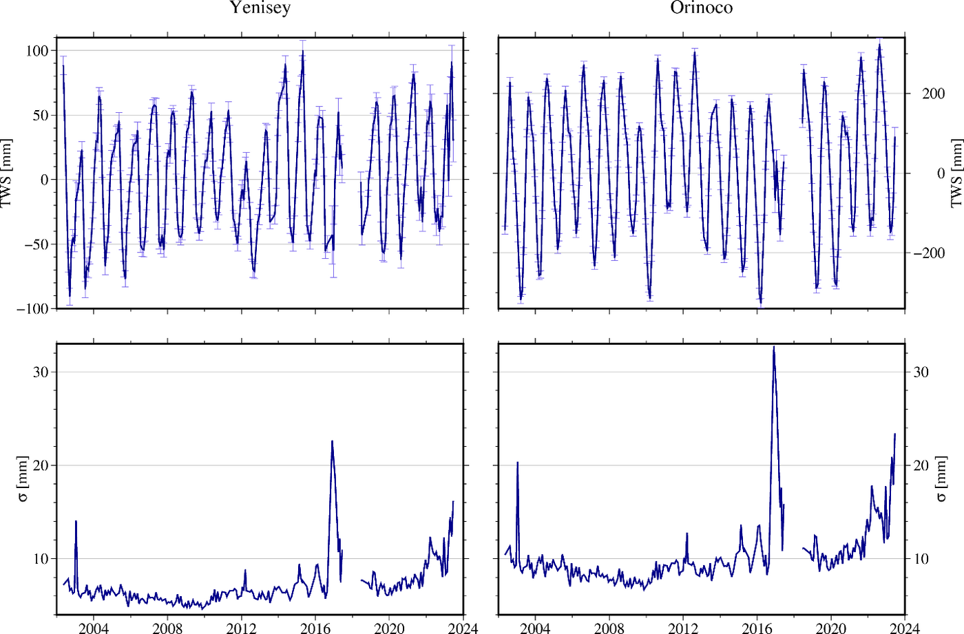
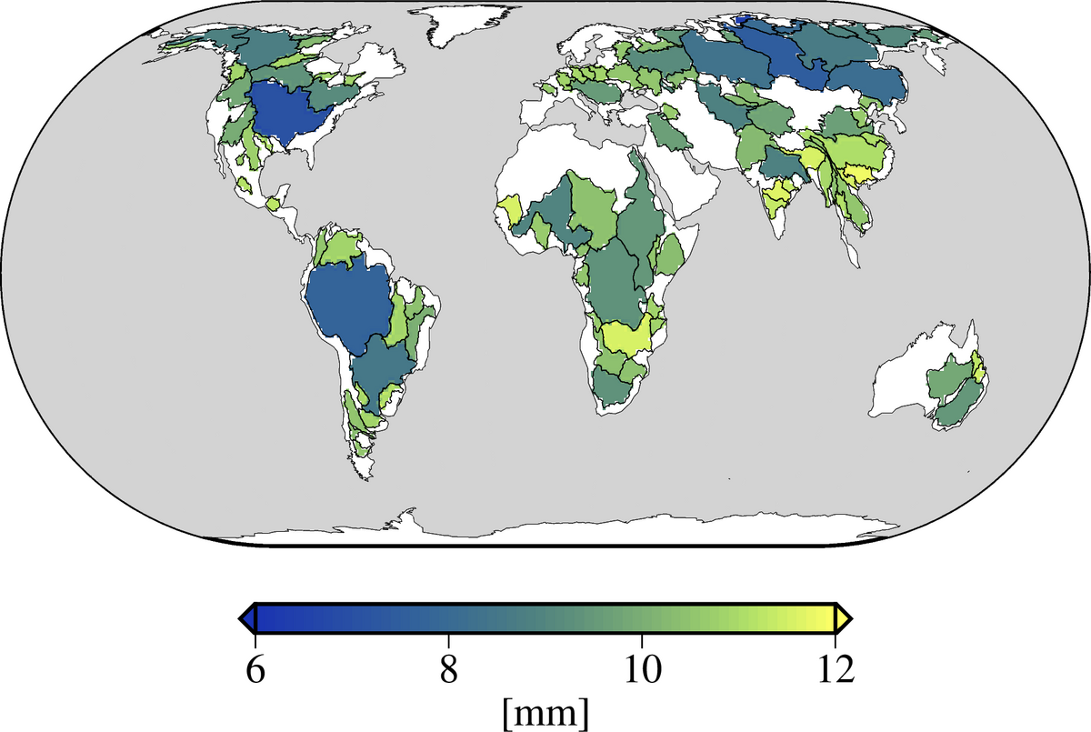
Due to the orbit geometry with a polar orbit, the data density of the observations increases towards the poles, which is reflected in a more accurate determination of the TWS values at higher latitudes. Therefore, the global estimate of monthly uncertainties must be scaled at least with latitude to obtain an exact estimate for each TWS grid point. Said orbit geometry also ensures that two points in the north-south direction are more strongly correlated with each other than in the east-west direction. The developed covariance model captures all this. This covariance model can also be used to determine the uncertainties of regional TWS time series (Fig. 3).
The GravIS data platform (Gravity Information System) offers pre-processed time series with uncertainty estimates for predefined areas such as river catchment areas. We provide a Python package for free so that users can also calculate such uncertainties for regions of their own choice.
Further Information
- Python Toolbox https://git.gfz-potsdam.de/boergens/regional-tws-uncertainty
- GravIS data portal gravis.gfz-potsdam.de
- Blog article by Meike Bagge about the influence of the last ice age on the accuracy of GRACE data
- Blog article by Roman Sulzbach about the influence of the ocean tides on the GRACE data
References
- Boergens, E., Kvas, A., Eicker, A., Dobslaw, H., Schawohl, L., Dahle, C., Murböck, M., Flechtner, F. (2022): Uncertainties of GRACE‐Based Terrestrial Water Storage Anomalies for Arbitrary Averaging Regions. - Journal of Geophysical Research: Solid Earth, 127, 2, e2021JB022081. https://doi.org/10.1029/2021JB022081
- Boergens, E., Dobslaw, H., Dill, R., Thomas, M., Dahle, C., Flechtner, F. (2020): Modelling spatial covariances for terrestrial water storage variations verified with synthetic GRACE-FO data. - GEM - International Journal on Geomathematics, 11, 24. https://doi.org/10.1007/s13137-020-00160-0